GEOINT


GEOINT Conference Wire 2: All Eyes on AI
Many of the discussions on Day 1 of the geospatial-intelligence conference centered on generative artificial intelligence.


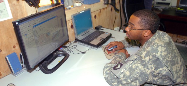
Rising Star: Senior Airman Christopher R. DeForge
Geospatial Analyst/Full-Motion Video Screener, 45th Intelligence Squadron, U.S. Air Force


GAO: Barriers to commercial satellite launch 'surmountable' for DOD
Centralizing data related to the Defense Department's work with commercial satellites could be one of the first tasks for a “Space Force.”


DOD sharply restricts use of geolocation devices and services
The Defense Department now prohibits personnel from using geolocation devices, applications or services in any area where military operations are being conducted.


How NGA plans to reinvent its acquisition efforts
The National Geospatial-Intelligence Agency is looking to revamp its acquisition process to lean heavily on small businesses and agile spending authorities.


IARPA looks to build 3-D geospatial models on the fly
Research program is developing automated systems that can quickly build complex 3-D models from commercial, satellite and airborne imagery.


Firm develops rugged navigation device for a GPS-denied environment
The Army and DOD are working with industry to engineer networking technologies able to connect combat forces in an environment where GPS systems are jammed or disabled.


Next-gen handheld radio can help save downed pilots lives
General Dynamics just released an upgraded radio for downed pilots to send rapid and secure GPS data to rescuers.
Individual Soldiers can have lightweight, mobile satcom terminal
Made of composite materials, the HM500 is engineered to enable dismounted units to have stronger beyond-line-of-sight connectivity.


How can cyber upgrades help satellite connectivity for small devices?
Cyber upgrades will allow ground-based operators to identify and share data on enemy missile launches faster.

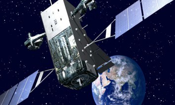
Air Force charts Wideband Global Satellite future
An Air Force analysis of alternatives considers a future plan for its constellation of Wideband Global Satellites.

The Pentagon's Cartographers Won't Be Robots Anytime Soon
Machines are increasingly taking on routine scanning tasks, but are still no match for human analysts.


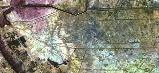
The Top Secret Military Mapmakers Spying on ISIS' Oil Smuggling
Analysts at the NGA have taken the tradecraft used to spy on Russia and China and turned it on black market oil transports.


The Pentagon's Satellite Spies Are Aiming for the Arctic
National Geospatial Intelligence Agency director Robert Cardillo sees the North Pole as the future nexus of geopolitical tensions.


Satellite Imagery Is Revolutionizing the Way We Respond to Wars
A 60-year-old technology is being reinvented to illuminate the world's blind spots and even predict and prevent conflicts and humanitarian disasters.


Can You Have a Transparent Spy Agency?
The head of National Geospatial Intelligence Agency doesn’t want to be a spy. By Patrick Tucker


How US Special Forces Uses Google Maps
Looking for your car in a parking lot? How about a rooftop sniper? By Patrick Tucker
The Public Will Soon Be Able to Buy Military-Grade Satellite Images
The view from space is about to get a lot clearer for the public. And that’s a good thing for the military. By Patrick Tucker
Featured eBooks