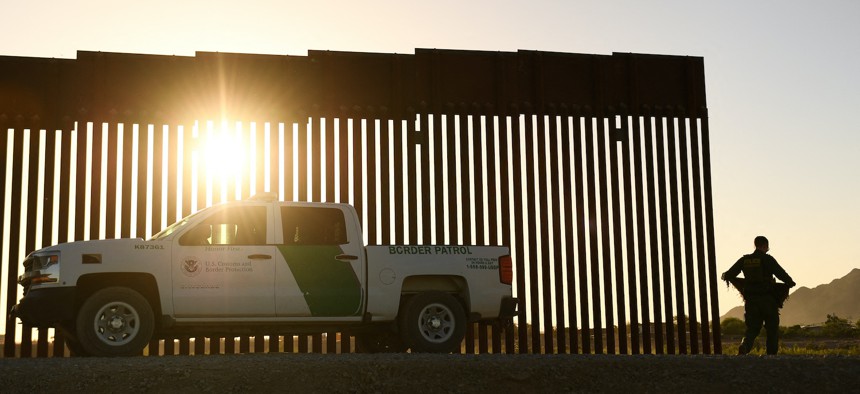
A Border Patrol agent walks between a gap along the border wall between the US and Mexico in Yuma, Arizona, on June 1, 2022. PATRICK T. FALLON/AFP via Getty Images


Satellite Data Could Boost Border Security, Disaster Response
Homeland Security relies on satellite imagery for its missions—and it wants more.

ST. LOUIS—Data should join radios, flashlight, and maps as indispensable tools in disaster response and border operations, Department of Homeland Security leaders say.
“It's not always conducive to operations to just give somebody a radio. I also need to be able to see where they're at,” said Dan Steadman, the acting assistant chief for U.S. Border Patrol, during the GEOINT conference.
Steadman recalled the fatal shooting of a border patrol agent by a fellow agent in 2012. He said he heard shots fired over the radio, and he believes the death could have been prevented with the right technology and information, namely the Team Awareness Kit or Tactical Assault Kit, known as TAK.
If TAK were available in 2012, the agents “would have seen each other, they would have known where each other were, they would have been able to respond appropriately to the situation that was going on. Being able to respond to sensors, they would have had overall situational awareness and that increased officer safety,” he said.
Initially developed in 2010 for military use, TAK can be used via app or software plugin on Android or iOS devices, web browsers, and with virtual or augmented reality tech. So far, about 80 percent of CBP's 20,000 border patrol agents are trained to use TAK, Steadman said. But the expansion wasn’t easy.
“The buy-in was difficult to begin with, especially with agents who were just thinking, ‘Well, this is just big brother.’ We have proven that it is not just big brother. We have proven that this is a life saving technology that can help us,” he said.
DHS has expanded TAK’s use since 2018 to mobile devices and other accessories for every border patrol agent. And the agency would like to use geospatial intelligence and satellite imagery for better maps that can be used offline, Steadman said.
“For anybody that's familiar with the border—not a lot of cell service. Utilizing ATAK, we need cell service,” he said, adding that the agency contracted with GoTenna to provide a mesh network so the app will work in areas with little to no cellular connectivity. “We want more of that. We want that mesh network. We want that data ingestion for offline mapping, updated satellite imagery to give agents on the ground as they're responding to officer safety type situations to have the most up-to-date information and how to better respond,” to blocked trails or pathways and other changes to the landscape.
Steadman also said he’d like to see predictive analysis for TAK so agents don’t have to rely on tracking physical footprints.
“As border patrol agents, we look at footprints a lot, or shoe prints a lot, to try to determine where to walk to. There should be a technology that can tell me with a high enough percentage rate of what a successful interdiction looks like and where I need to go to make that,” he said.
Weather as an intel asset
Homeland Security relies on satellite imagery for its missions, often working with the National Geospatial-Intelligence Agency, including natural disaster response and analyzing critical infrastructure. But weather and atmospheric conditions can make that challenging.
“You're really limited to daylight and cloud-free [conditions],” said Tom Madigan, the senior requirements officer for the Department of Homeland Security, who handles the department’s satellite imagery collection.
That means relying on synthetic-aperture radar, or SAR, satellites which can render two- and three-dimensional images that require expertise to use, Madigan said. “That's where things like change detection, analytics, and value-added type production really comes in handy to inform state and local personnel, especially in search-and-rescue type response operations.”
For example, the Federal Emergency Management Agency, FEMA, wants flood detection capability to determine water levels following a storm, he said.
But what if weather conditions could be integrated into products? Christian Wohlwend, technical fellow and research and development space systems engineer for Northrop Grumman, told Defense One it’s possible.
“Those signals that we're talking about coming down from space are impacted by either the terrestrial environment—clouds, aerosols, temperature gradients, and relative humidity—can cause a bending of your signal as it transmits, and so it might not go where you want it to go. Or it might be a reduced signal, so you can't actually receive it,” Wohlwend said.
The result: disruption to data transfer or communications that use satellite-based sensors. But researchers are working to make weather conditions part of intel gathering.
“We want to try and bring all those things together so that weather can be part of the intelligence collection process, and can actually allow them to mitigate the impacts so we can subtract weather out of the equation,” Wohlwend said. “We want to produce a forecast that allows them to make that good decision,” in the case of needing a cloud- or dust-free environment to have clear images.
Since the technology exists, Wohlwend said, the next step is integrating it with augmented reality in a tactical edge solution. Doing so would “give them that opportunity to see things very rapidly, to ingest that data into their decision process to have weather, intel, and engineering all in the same area…so they can make a quick decision,” he said.