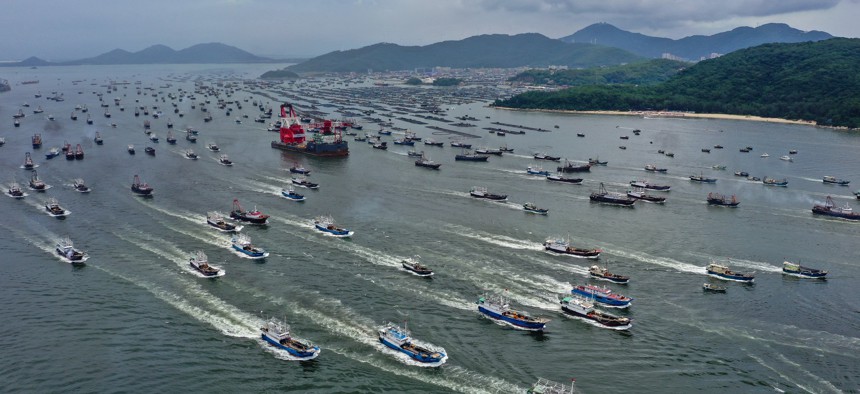
Fishing boats set sail from Yangjiang in China's Guangdong province, heading for the South China Sea on August 16, 2022. Liu Xiaoming/VCG via Getty Images


What’s missing from the Quad’s ISR partnership
The year-old Indo-Pacific Partnership for Maritime Domain Awareness can’t do the job with satellites alone.
Over the past year, various developments in Washington and the Indo-Pacific region have shown the growing multinational commitment to using existing intelligence, surveillance, and reconnaissance capabilities to monitor and discourage antagonistic maritime activities, including by China. Most significantly, in May 2022, the “Quad” nations—the United States, Australia, Japan, and India—announced the creation of the Indo-Pacific Partnership for Maritime Domain Awareness, or IPMDA, to monitor illegal fishing, humanitarian crises, maritime security, marine conservation, and related issues in the region.
IPMDA’s most significant activity involves disseminating unclassified data collected by commercial satellites to improve the common operating picture of participating nations and bolster information sharing across regional fusion centers, including in India, Singapore, the Solomon Islands, and Vanuatu. Harnessing the growing power of commercial satellites is wise. However, if IPMDA relies solely on commercial space-based collection, the initiative will fall short of giving Indo-Pacific nations what they need to know about antagonistic Chinese maritime activity and other regional security threats.
To avoid this, the Quad and its partners should furnish IPMDA with a small fleet of unmanned aircraft systems to monitor regional hotspots. This would provide more granular and persistent surveillance of important ISR collection areas than commercial space-based collection alone. First, drones provide full-motion video and other forms of high-resolution imagery continuously, whereas commercial satellites do not produce video and collect imagery only intermittently based on their revisit rates. Second, drones equipped with multiple sensors, such as a camera-and-signals-intelligence pod, can find, fix, and track targets independently by correlating observations across different collection methods in near real-time, something commercial satellites do not do.
In a recent study, we laid out how a fleet of just three drones would strengthen IPMDA’s surveillance of the South China Sea, an area of immense importance for regional security. Seeking to add loitering time in more important areas, we analyzed basing in Guam and the Philippines along with different aircraft endurances (40-hour and 80-hour), determining that Philippines-based, 40-hour endurance aircraft perform best according to most criteria. This finding reaffirms the common-sense notion that better basing enables better ISR collection in the vast Western Pacific. To borrow the saying from real estate, Indo-Pacific ISR aircraft operations are all about location, location, location.
Our research suggests three insights about integrating drones into IPMDA. First, combining broad collection by commercial satellites with targeted collection by drones should prove more effective than satellites alone and more feasible than drones alone. A contractor-owned, contractor-operated fleet of three drones would cost IPMDA about $50 million per year, an expense that could be split among those Quad members willing to contribute.
Second, IPMDA would improve its surveillance of the South China Sea by operating drones from Vietnam. The failure of the best performing three-aircraft configuration we studied to surveil important areas near Vietnam indicates that Philippines basing is incredibly helpful, but alone insufficient, for maintaining comprehensive maritime domain awareness in the South China Sea. The most promising Vietnamese bases would include Da Nang in central Vietnam and Nha Trang, Cam Ranh, or Phan Rang in south central Vietnam due to their proximity to important ISR collection areas.
Third, IPMDA would improve its surveillance of the South China Sea and adjacent areas by operating long-endurance drones from Japan, Australia, Singapore, or Malaysia. Though such aircraft could be flown from Guam, the route to the South China Sea crosses a lot of open ocean, limiting the opportunity for collateral collection en route. If the Philippines or Vietnam proved unwilling or unable to host drones, then operating them from the four countries above would allow South China Sea-bound aircraft to fly past geopolitically significant areas such as Taiwan and Southeast Asia’s maritime chokepoints. This setup would increase each sortie’s return on investment and deliver valuable collection to countries outside the South China Sea.
IPMDA could begin implementing these concepts right away if the Quad and its partners stood up a small fleet of contractor-owned, contractor-operated UAS. Political support for conducting ISR operations has grown in Washington and the Indo-Pacific region, but the window of opportunity to act may not last long. Policymakers should not delay in taking practical steps to ward off the growing dangers to regional security posed by China and other malicious actors.
Travis Sharp is a senior fellow and the director of defense budget studies at the Center for Strategic and Budgetary Assessments (CSBA). Thomas G. Mahnken is president and CEO of CSBA. Tim Sadov is a research assistant at CSBA. This commentary is adapted from their recent CSBA report, “Extending Deterrence by Detection: The Case for Integrating Unmanned Aircraft Systems into the Indo-Pacific Partnership for Maritime Domain Awareness.”